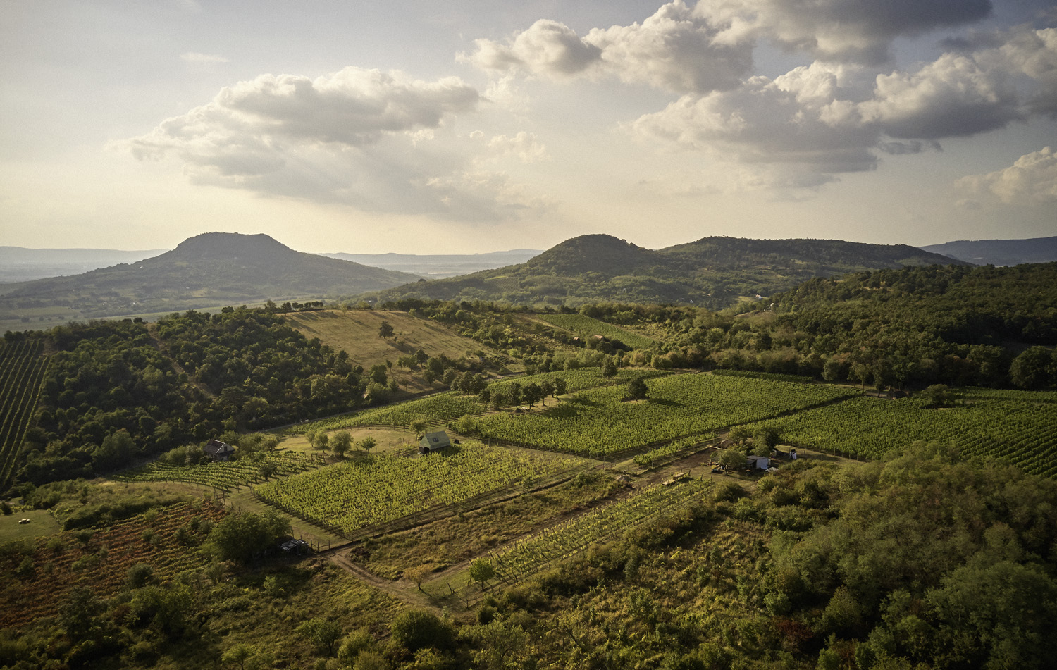

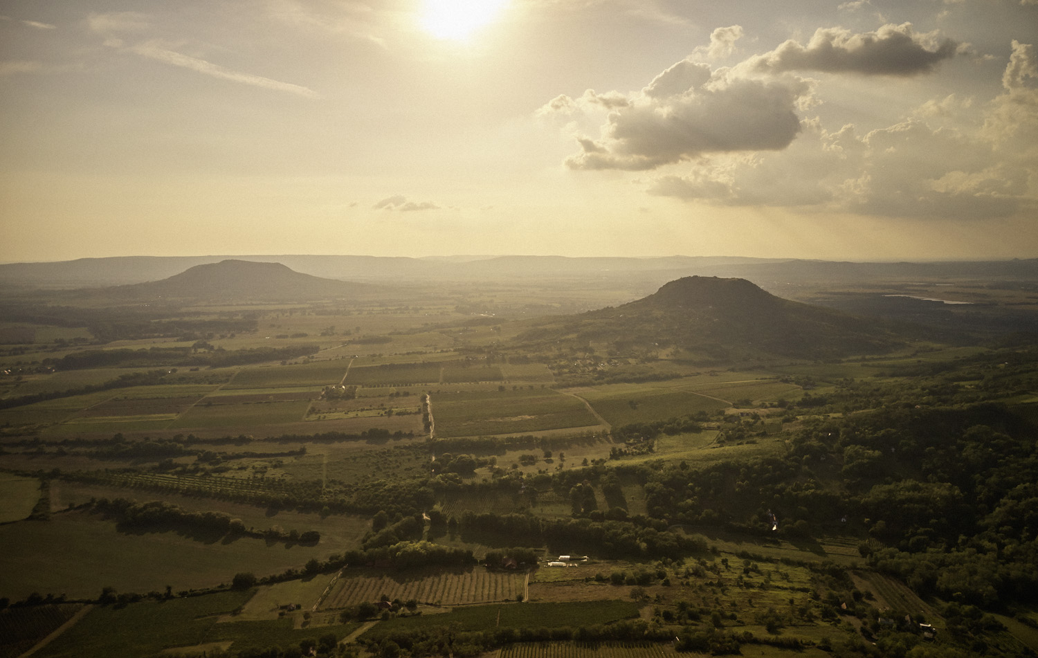
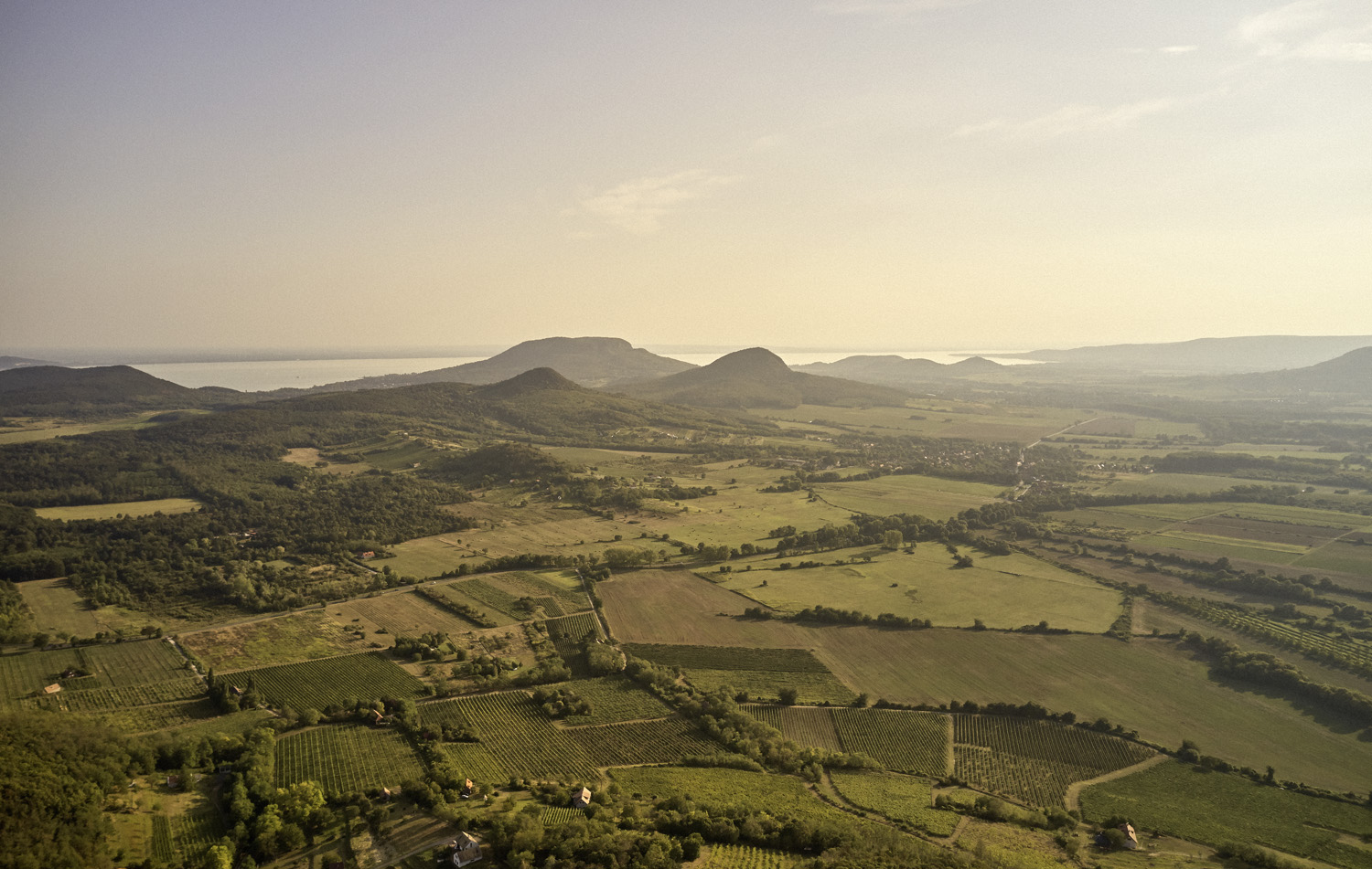
Balaton-Felvidéki Wine district
History | National Geography
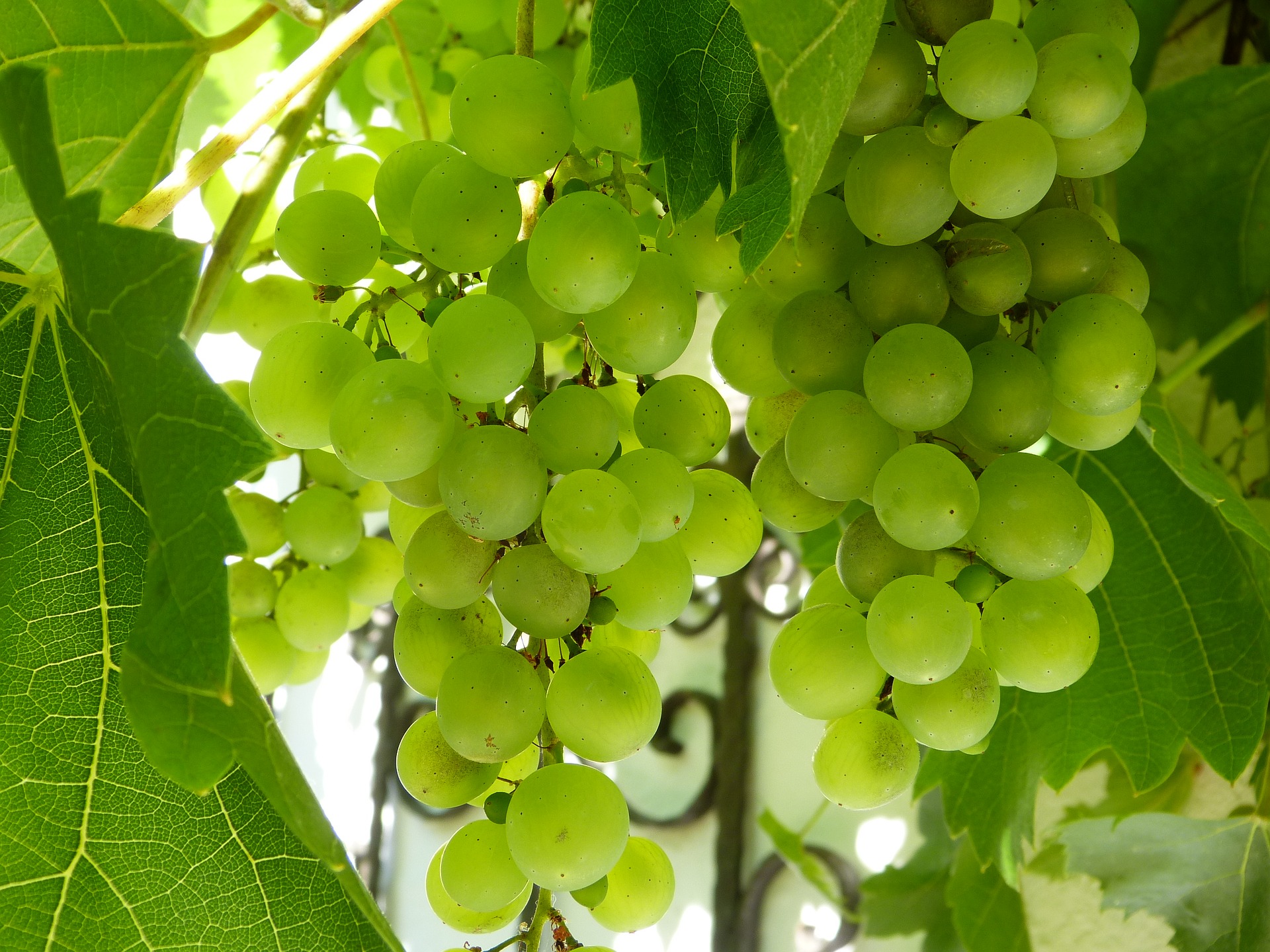
Vineyards | Origin protection
History
The Romans had already recognised in the 1st century BC that lavender, grapes and almonds thrive in the area. They were followed by the Goths and Huns, and then the next significant ethnic group was the Hungarian tribes, who appeared in the area around the 9th to 10th centuries. The invading Turkish armies ravaged the countryside after the Hungarian defeat at the Battle of Mohács in 1526, but were unable to capture the most important castles. Sümeg, for example, never fell into Turkish hands, but the region’s vineyards withered away due to a lack of labour.
After the Peace of Szatmár (1711), which ended the Rákóczi War of Independence, the area ended up in the hands of the Eszterházy and Festetics families, but the church also owned significant estates. A good example of this is Sümeg, where we owe the current Baroque town centre to Bishop György Széchenyi, who surrounded the town with a stone wall.
Many vineyards were grubbed up at the end of the 18th century and the beginning of the 19th century due to a serious overproduction crisis, but the Napoleonic Wars brought about a revival. In 1835, the wine-producing areas of Zala County were classified according to the quality of their wines, with only Tapolca and the vineyards of the Kál Basin included in the first class.
At that time, most of what is now considered the Balaton Highlands wine district still belonged to the Badacsony wine region. The most famous wine merchant of the age, Vincze Ramasetter of Sümeg, exported the region’s wines with considerable success. The boom came to an end with phylloxera, and Sümeg and Tapolca lost their role as centres of the wine trade.
The 1941 ministerial decree reduced the Badacsony wine region to roughly its current size, thus depriving the displaced settlements of any chance of revival. The wine district as we know it today was established in 1999 and given the name Balaton Highlands. Since then, there has been no breakthrough in terms of winemaking in the settlements near Keszthely and Hévíz, but there has been in the Kál Basin and Sümeg.
Natural Geography
The current topography of the Kál Basin began to form around five million years ago, when the volcanoes in the area ceased to be active. At that time, hills formed from the sediments of the Pannonian Sea dotted the landscape, from which scoria volcanic cones and tuff rings rose. The flat hills in the Kál Basin are almost entirely composed of volcanic debris rock, with very little lava rock. Lapos-Hegyestű, Kis-Hegyestű, Kerekidomb and part of Harasztos-hegy in village of Kékkút are of this origin. The surface at that time was still covered by the sand deposits of Lake Pannon, which have only remained intact to this day in places where volcanic rocks above them protected them from water and wind erosion like a cap.
The southern two-thirds of the range, which stands out almost like an island from its surroundings, consists mainly of dolomite, except for the limestone area above village of Balatonederics. These highly karstified rocks quickly drain rainwater deep underground, so continuous surface watercourses rarely form in the valleys. The average annual rainfall of around 700 mm in the Keszthely area is mainly due to the humid air of Mediterranean cyclones, which often cause severe thunderstorms in the region as they arrive from the Mediterranean and Adriatic seas. Strong north winds are common in the interior of the hills, which are amplified and carried towards Lake Balaton by the valleys running in that direction. However, vines and almond trees flourish on the southern slopes of the hills thanks to an almost Mediterranean microclimate caused by the waters of Lake Balaton. It not only has a balancing effect on its immediate environment, but also reflects and amplifies the incoming sunrays.
The area could simply be considered the little brother of the Kál Basin, with even the oldest rocks barely 200 million years old. The surface we know today began to form around 2.5 million years ago, when parts of the range of hills rose sharply. Erosion began, with water carving deep trenches into the Triassic rocks after the sediments, while thick sedimentary cones were deposited at the bottom of the deeply cut valleys by sudden torrential downpours.
Meanwhile, erosion in the northern part of the range exposed traces of volcanic activity, namely basalt flows that were once unable to break through the thick surface layer and thus spread out beneath the surface. However, after the deterioration of their environment, the basalt masses slipped and broke off in places. Moreover, the rock, although considered resistant, fell victim to the impending ice age, as its characteristic columnar separation (see Hegyestű) favoured the infiltration of water.
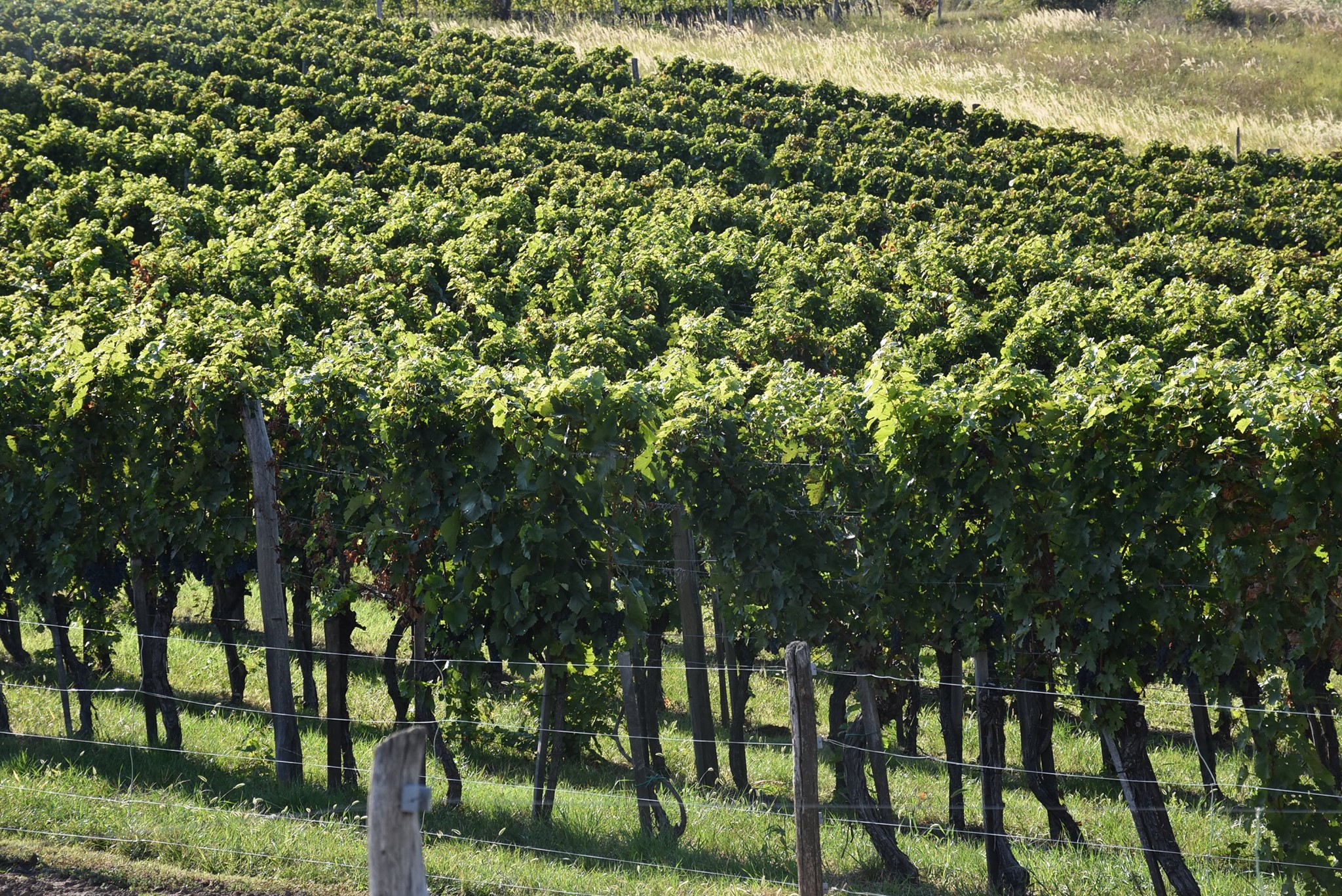
Vineyards
The Kánya-irtás vineyard in village of Lesencefalu is located just below the forests, south of the village. The vines benefit from the cool breezes flowing down from the forest at an altitude of 185-230 metres. The area has southeastern exposure, mainly with Ramann-type brown forest soil on limestone and limestone debris, on mainly dolomitic soil. Not far away, the Úr-szél vineyard lies southeast of the road between Lesencetomaj and Lesencefalu, on the eastern slope of the Keszthely Hills looking towards Lake Balaton. The area wedged between the two settlements is bordered by a forest strip to the south and a road to the north. It is a fairly large vineyard, with an altitude of 130-190 metres above sea level and a clear eastern slope, which is also accompanied by significant southern exposure on the western side. The top layer of soil is about one and a half metres of Ramann-type brown forest soil mixed with some volcanic ash, basalt debris and pebbles, rich in calcium and phosphorus. Underneath is yellow loess, with a dolomite base from the Pannonian Sea. It boasts excellent water management. This vineyard also enjoys the coolness flowing down from the Bakony Hills at night and the mist rising from Lake Balaton during the day, which tempers the area.
The village of Balatonederics’s vineyards are typically located on the lower slopes of the 406-metre-high Ederics Hill and Szabad Hill. Ederics Hill is limestone, which is considered a separate formation: the Upper Triassic Ederics Limestone Formation is 100-250 metres thick, and is comprised of light grey, granular limestone. The vineyards, including Fekete kastély and Svastics-hegy, are located on the lower slopes of Ederics Hill and Szabad Hill. This is an extremely dry growing area, with the hills pushing up the clouds, resulting in around 400 mm of rainfall per year.
The Fekete kastély vineyard is currently an underdeveloped growing area with no well-known wineries. The windy, east-facing Svastics-hegy vineyard lies west of the northern part of Balatonederics, at an altitude of 160-230 metres, directly below the forest and the steep hills. It was named after Gyula Svastics, a former large landowner in Balatonederics, who once owned the estate. The legendary Bece-hegy, which now belongs to Balatongyörök, stands out clearly due to its dense development. There are now more houses than vineyards in this once famous growing area, stretching between 125 and 225 metres above sea level.
The best growing area on the eastern side of the wine district is Fekete Hill, located on the border of Köveskál, which got its name from its black basalt cover. There are dozens of vineyards surrounding the hill, such as Öreg-hegy, Tőttösi-dűlő (Szentbékálla), Fekete-hegy alja, Csák-völgy, Pellengérdűlő, Csere-kúti-dűlő, Töltési-dűlő and Vaskapu (all in Köveskál), as well as Szarkó, Kötye and Pirkanc (Balatonhenye). The southern edge of Fekete Hill is a large basalt plateau, unfortunately with fewer and fewer vineyards. The soil is particularly excellent because it is not compact, rather crumbly, greyish-brown, well-layered tuff, which has two advantages: on the one hand, the vine roots can easily penetrate it, and on the other, there is no reason to mine the hill. The geological sandwich of Fekete Hill consists of basalt on top, tuff in the middle and some tuffaceous, fire-stone limestone at the bottom, with basalt, limestone and dolomite particles mixed in some places. The geological diversity of Fekete Hill and the high heat sums on its southern side, which faces a closed basin, create a first-class climate. The vineyards are located at an altitude of 165-310 metres, initially facing west (Öreg-hegy, Tőttösi-dűlő), then turning to purely southern exposure above Köveskál, and finally the vineyards of Balatonhenye are rather southeastern, in some places eastern.
The Farkas-tető vineyard is located northwest of Szentbékkálla. This is the northwestern corner of the Kál Basin, bordered by Sátorma Hill and Fekete Hill to the north, Lake Balaton and the Stone Sea on the outskirts of Szentbékkálla to the south. The two hills are of basalt volcanic origin, while the valley cutting into the sediments of the Pannonian Sea in front of them is filled with solidified pyroclastic flow, which forms the bedrock.
The western side of Boncsos Peak, located south of the village, is home to the country’s first (!) protected area of origin, Monostorapáti’s Táltoshegy. The name of the vineyard, which was registered in 2002, is credited to the initiator, winemaker Sándor Tóth. Boncsos Peak (448 m) is the highest point in the area and also the northern extension of Fekete Hill, which towers above Köveskál. It is basically composed of basalt lava and volcanic scoria that settled on top of it during the final phase of volcanic activity. This reddish material often contains other components ejected from the vent, including pieces of rock that have reached the surface with deep magmatic rocks. Pannonian sand and clay have settled on the western slope of the former volcano, creating soil that is high in lime and often dotted with fossils. The vineyards are located at an altitude of 250 to 340 metres above sea level on the eastern side of the north-south valley (i.e. facing west). The higher areas are in the Bene-hegy vineyard, while the upper boundary of the Táltoshegy vineyard is located at an altitude of approximately 280 metres.
Another of Hungary’s earliest protected production areas, also thanks to Sándor Tóth, is Áldozó. The twin peaks of Áldozó Hill and Bondoró Hill rise northeast of Monostorapáti, and Áldozó is located on their double southwestern slopes at an altitude of 160-245 metres above sea level. The area is bordered by forest to the north and east, forest and the road leading to the village of Kapolcs to the south, while to the west it is bordered by Monostorapáti and a narrow strip of forest. Traces of volcanic activity can be found everywhere in the valley, the most beautiful examples of which are the fist-sized, green and violet-coloured olivine “bombs,” recognised as geological landmarks, which often lie on the surface.
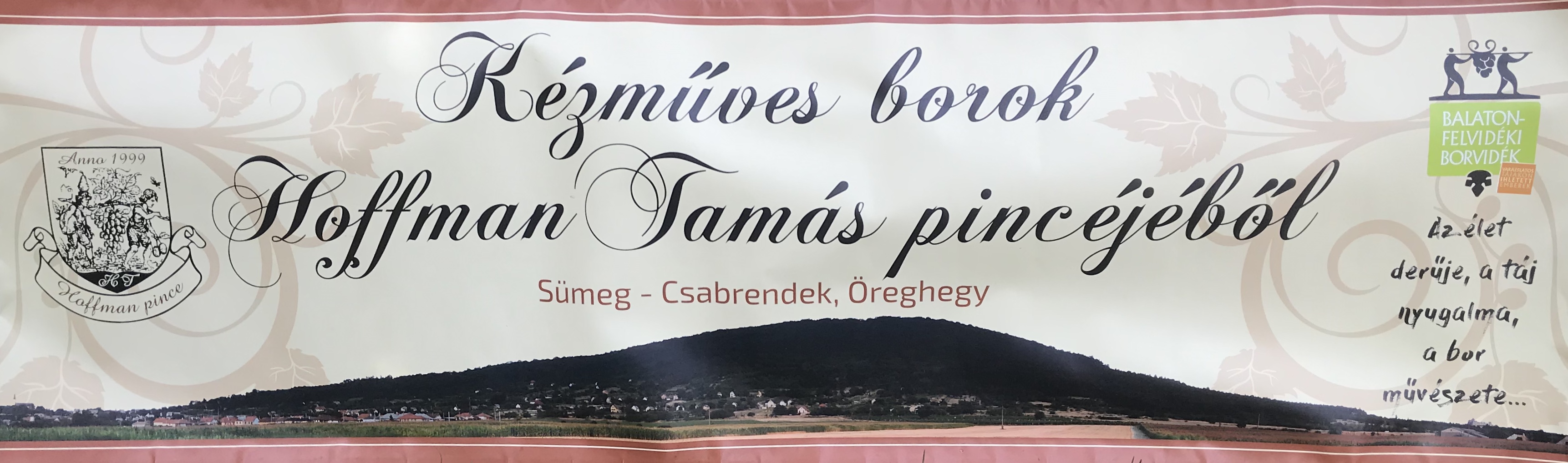
The Várhegy vineyard in Sümeg is a very special case. Even at first glance, it is clearly a grand cru, which was recognised by two young winemakers who began planting it in 2007. The 270-metre-high limestone block (Várhegy, or Castle Hill) provides excellent conditions for grape cultivation, as it is steep, has minimal topsoil, and the limestone bedrock breaks through to the surface in many places. Besides Várhegy, the slopes of Baglyas-hegy, Öreg-hegy, Új-hegy and Hajnal-hegy were also demarcated in the Sümeg PDO
Origin protection
The wine district has three designations of origin, or rather, as we will see, two and a half. It already started with one and a half in 2012, because the Kál PDO partially overlaps with the Balatonfüred-Csopak wine region. The Sümeg PDO was added to these in 2021.
The original wine district designation did not specify conditions beyond those in the wine law, but it did define 41 vineyards. The five Sümeg vineyards were removed from the product specification when the Sümeg PDO was established in 2021.
The Kál PDO area is limited to eight settlements in the Kál Basin, with 31 demarcated vineyards. In addition to stricter yield averages than the wine district regulations, the concepts of Káli Királyi wine (bor) and Káli Királyi main wine (főbor) were introduced, which can be late-harvest white wines.
The Sümeg PDO’s premium line is called “Penta”. The grapes used in these wines must come from organic estates and the wines must comply with state regulations for natural wines. Thus, Sümeg PDO became the country’s first natural wine with protected designation of origin.


Events
Domestic and international wine programs